Table of Contents
A Brief History of the Galapagos Islands
The Galapagos Islands are the result of volcanic activity approximately 5 million years ago.
As these young islands were cooling off two million years later, certain species gradually arrived in the archipelago. It is speculated that these newcomers arrived in the Galapagos on large rafts of vegetation that broke off from the shores of Central and South America. Upon arriving in the archipelago, these species had to adapt to a radically new environment rapidly.
These adaptations led these species to evolve in an entirely new way, completely separate from their continental relatives. Consequently, numerous species in the Galapagos are so unique that they are now classified as endemic species (i.e., not found anywhere else in the world).
When Darwin published his book “On the Origin Of The Species,” the nineteenth-century thinker confirmed a long-held suspicion that species were not immutable, praising the archipelago as a living laboratory that has become one of the most significant places for investigating and researching evolution.

The Discovery of the Galapagos Islands
The first known person to set foot on the Galapagos Islands was Tomas de Berlanga, a Spanish bishop. His discovery of the Galapagos Islands was entirely accidental and occurred in 1535 as he was navigating towards the coast of Peru from Central America on an apostolic mission. His journey there experienced an unexpected detour when unusual winds and the Panama Current pushed his ship towards the Galapagos, teeming with spectacular and eccentric creatures. “The birds here are so silly,” he wrote to Charles V (the King of Spain), “they know not how to flee.”
And that’s how the Galapagos Islands were officially (albeit unintentionally) discovered in March of 1535. Eventually, the bishop’s party managed to sail back to the continent. The islands were reported to Spain, but no effort was made to colonize them based on the somewhat eccentric and uninviting descriptions that Berlanga gave.
Centuries later, in 1832, Ecuador took possession of the archipelago and gave the islands their official name. More than a century after that, Metropolitan Touring pioneered and developed the concept of responsible tourism to the Galapagos, designing carefully planned itineraries to show off the archipelago’s delicate beauty without harming the natural processes inherent to their unique ecosystems.
After arriving less than 500 years ago, humans are some of the newest “living organisms” currently inhabiting the Galapagos.
The first visitors to the Galapagos
Sometimes, the Galapagos become invisible to the naked eye, particularly under the dense veil of fog in the early morning. Remember: the waters surrounding the islands are rather cold despite being in the tropics. This characteristic produces a fine mist (known locally as garúa) when cool air right above the water mixes with warmer patches of air overhead, frequently obscuring views of what’s off in the distance. The presence of this phenomenon is precisely how the islands got their Spanish nickname “Las Encantadas” (which can be translated as the ‘enchanted’ isles but also ‘bewitched’), as the islands would suddenly appear as the mist evaporated and just as quickly disappear as the fog engulfed them.
Then, in 1570, a map of the Spanish New World (drawn by a Flemish cartographer) began circulating throughout the Caribbean, presenting the elusive islands to the world for the very first time with the rather unpoetic name of Islas de los Galapagos (Islands of the Giant Tortoises). This map eventually came to be used by buccaneers to maraud the Pacific Ocean in the 1600s.
During the 17th and a good part of the 18th centuries, astute pirates eventually came to use the Galapagos as a haven of sorts – the archipelago provided them with a safe place to hide, repair their vessels, plan future raids, and stock up on fresh meat (unfortunately killing tortoises by the thousands in the process). Despite using the Galapagos for these means, they left no buried treasures.
Late in the 18th century came the whalers that made the archipelago a center of operations for their trade, but after several years, the whalers, too, left when the profits weren’t worth the cost and time it took to get to the Galapagos. These whalers came to be the human group that left the most devastating impact on the islands: even more giant tortoises were killed, and domestic animals were introduced into the Galapagos – factors that would later serve as the basis for implementing a solid conservation campaign in the Galapagos.
In sum, nobody wanted the Galapagos. Not until 1832, when Colonel Ignacio Hernandez of Ecuador, with instructions from General Jose de Villamil, planted the Ecuadorian flag on Floreana Island on February 12th, solidifying the country’s possession of what he officially named Las Islas Galapagos on behalf of his government. Some sixty years later, in 1892, most of the islands received a Spanish name, the majority of which are related to the discovery of America.
And that’s how the Galapagos Islands were officially (albeit unintentionally) discovered in March of 1535. Eventually, the bishop’s party managed to sail back to the continent. The islands were reported to Spain, but no effort was made to colonize them based on the somewhat eccentric and uninviting descriptions that Berlanga gave.
Centuries later, in 1832, Ecuador took possession of the archipelago and gave the islands their official name. More than a century after that, Metropolitan Touring pioneered and developed the concept of responsible tourism to the Galapagos, designing carefully planned itineraries to show off the archipelago’s delicate beauty without harming the natural processes inherent to their unique ecosystems.
After arriving less than 500 years ago, humans are some of the newest “living organisms” currently inhabiting the Galapagos.
Galapagos Islands Map

Climate & Weather
Weather seasons in the Galapagos Islands are set and defined entirely by the arrival (or departure) of the currents surrounding them.
- The Hot Season begins in December and gradually works its way until May. During these months of the year, conditions are quite “tropical” in the traditional sense, specifically as the waters from the Panama Current bathe the islands. Seas are generally calm, and occasional tropical showers can be expected, turning the islands green and lush. Temperatures are hot and humid and can range from 26 ºC to 30 ºC (79 ºF – 85 ºF), while the water temperature averages 26 ºC (79 ºF). Underwater visibility is generally excellent, with around 20-25 meters (60-80 feet). This is the time of the year when swimmers and snorkelers will experience a proper tropical environment: days are sunny and warm, and due to these conditions, our planned activities are scheduled and arranged in such a way as to avoid walking during the hottest hours of the day when wildlife is not so active.
- From June to November, a desert gradually spreads over this aforementioned tropical paradise. As the southeast trade winds push the cooler water into the archipelago, evaporation decreases, and this forms a thin layer of clouds that, throughout the day, tend to disperse. This time of year is known as the Dry Season, and it is here when the seas will typically experience more waves due to the strong prevailing winds. The fact that hardly any rain during this time of year has given the islands the title of one of the driest places in the tropics. Sea temperatures drop to 20 ºC – 23 ºC (70 ºF – 72 ºF), cooling the air temperatures to 23 ºC – 26 ºC (72 ºF – 79 ºF). Due to stronger winds, you can expect a wind-chill factor during late afternoon walks or while you’re out on the cruise decks in the evening. Even though most swimming will take place at midday hours, we advise that snorkelers use a wet suit during this season.
- Regarding Galapagos weather, one fun fact is that there is no bad weather. Ever. Our advice to many of our guests who plan to return to the islands with our Galapagos tours is to do so at a different time of year and season, simply so you can see the islands from a whole new perspective that will bring many more enchanting surprises!
Top Islands
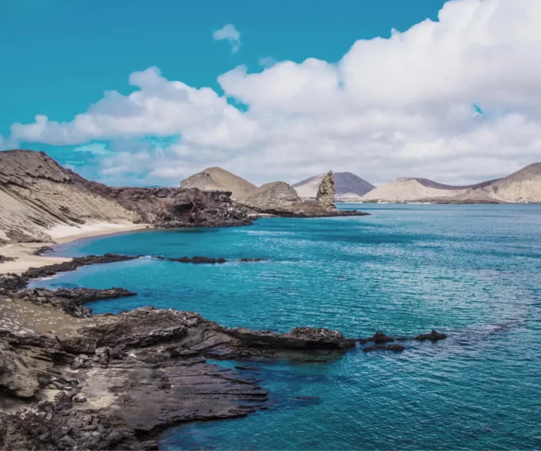
Bartolome Island
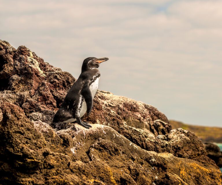
- Wildlife highlights: As a young island, only pioneer species have been able to thrive here, the most iconic of which is the Galapagos penguin.
- Unique features: Up at its viewpoint, visitors are rewarded with panoramic views of the island’s concave peninsula, Pinnacle Rock, and neighboring Santiago Island.
- Visitor sites: Bartolome Viewpoint, Bartolome Beach, and Pinnacle Rock
Chinese Hat (aka. Sombrero Chino)
- Wildlife highlights: Visitors will get a glimpse of American oystercatchers in action, along with marine iguanas, lava lizards, and Sally Lightfoot crabs.
- Unique features: Starting from a crescent-shaped and white sandy beach, this 400-meter (1,312-foot) long trail provides some wonderful landscapes to view. Good swimming and snorkeling opportunities in the cove area will see visitors swimming amidst whitetip reef sharks and tropical fish.
Española Island
Enjoy Española Island’s beautiful landscapes.
Located in the southeastern corner of the archipelago, Española Island offers visitors an amazing cliff-side landscape and an overwhelming diversity of wildlife.
- Wildlife highlights: Galapagos albatrosses (this is the only island where you can spot them!), sea lions, lava lizards, Nazca boobies, blue-footed boobies, colorful marine iguanas, Darwin’s finches, and yellow warblers.
- Unique features: Home to the largest nesting colony of blue-footed boobies, and the only island in Galapagos with a Waved Albatross colony (present from April to December), mockingbirds and lava lizard endemic to Española. Interesting geological formations such as the famous “blowhole.”
- Visitor sites: Punta Suarez and Gardner Bay
Fernandina Island (Narborough)
The most western and youngest of all the islands. This massive large-shield volcano is the home of continuous volcanic activity. From time to time an eruption may be witnessed too. The most recent eruption took place in April 2009!
- Wildlife highlights: densest colonies of marine iguanas, sea lions, nesting colony of flightless cormorants and penguins, Galapagos snakes, intertidal pools.
- Unique features: Fernandina Island may be rated as one of the most pristine islands in the world, due to the absence of introduced mammals. Intertidal pools bloom with marine life.
- Visitor sites: Punta Espinoza
Floreana (Charles or Santa Maria)
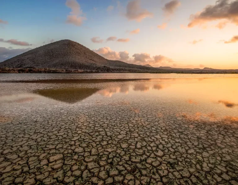
An island in the southern half of the Archipelago, dotted with parasitic cones, evidence of continuous and prolonged volcanic activity of a not-so-distant past.
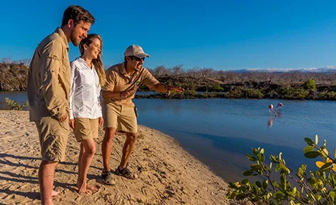
- Wildlife highlights: lagoon birds (stilts, whimbrels, ducks, egrets, and flamingos), sea turtles and rays (seasonal), Galapagos flycatchers.
- Unique features: volcanic parasitic cones, greater flamingos, endemic Floreana mockingbird, endemic “hairy” Scalesia plant, flour beach, great snorkeling. The human history of the islands and post office barrel.
- Visitor Sites: Punta Cormorant, Post Office Bay, Champion Islet, Baroness Cove.
Genovesa Island (Tower)
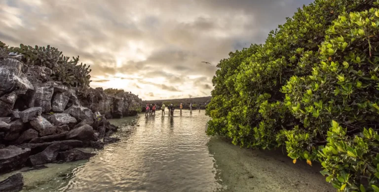
The horseshoe-shaped island has a volcanic caldera whose wall has collapsed, forming the Great Darwin Bay. No historical eruptions are known from Genovesa, but there are very young lava flows on the flanks of the volcano. This island is known as Bird Island, because of the large and varied bird colonies which nest here.
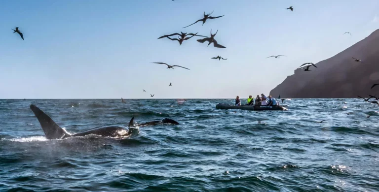
- Wildlife highlights: Nesting colonies of Nazca boobies, red-footed boobies, noddy terns, shearwaters, tropicbirds, storm petrels and great frigate birds. Galapagos sea lions and Galapagos fur seals.
- Unique features: Interesting vegetation such as “spineless” prickly pear cactus from the genus Opuntia and “Palo Santo” forest.
- Visitor Sites: Darwin Bay, Prince Philip’s Steps
Isabela Island (Albermarle)
One of the archipelago’s western islands and the largest of all. It is made of six large shield volcanoes fused into one island (Ecuador, Wolf, Darwin, Alcedo, Sierra Negra, and Cerro Azul). The highest point in Galapagos is found at Wolf Volcano (1,707 m; 5,600 ft.).
- Wildlife highlights: Galapagos penguins, flightless cormorants, sea turtles, marine iguanas, volcanic landscape.
- Visitor sites: Punta Vicente Roca, Urbina Bay, Tagus Cove.
North Seymour
A small island but packed with interesting creatures and views, created from geological uplift, and covered with typical arid vegetation; mainly prickly pear cactus and “Palo Santo” trees.
- Wildlife highlights: Nesting colony of magnificent and great frigate birds, swallow-tailed gulls, blue-footed boobies. Breeding colonies of Galapagos sea lions and marine iguanas.
- Unique features: Land iguanas, white coral heads along the shore, endemic “Palo Santo” trees.
- Visitor sites: One half of the walk is flat and easy walking along the beach, while the other half is rocky and over boulders. Good traction footwear needed. Snorkeling is possible when conditions allow.
Plazas Sur Islands (South Plaza)
South Plaza is a small island off the east coast of Santa Cruz Island and forms part of two islands known as Islas Plazas. It was formed not by volcanic activity but by an uplift of the seafloor. It provides a wonderful cast of Galapagos creatures and beautiful landscapes.
- Wildlife highlights: red-billed tropicbirds, swallow-tailed gulls, Galapagos land iguanas.
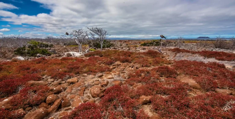
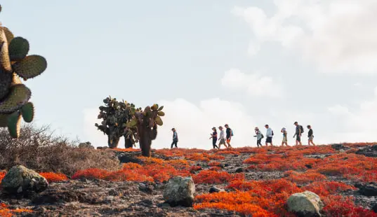
- Unique features: This island was formed by lava up streaming from the bottom of the ocean. Despite its small size, it is home to a large number of species and it is famous for its extraordinary flora. Very attractive are the beautiful prickly pear cactus trees and of course the large colony of Galapagos land iguanas. Depending on the season, the Sesuvium ground vegetation changes its color from intense green in the rainy season to orange and purple in the dry season.
Rábida (Jervis)
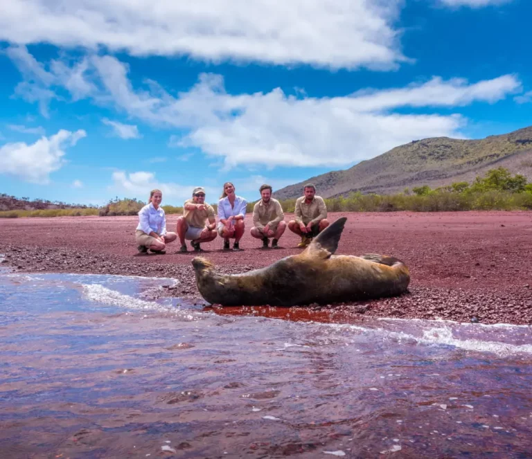
Rábida is a small, central island exposed to the western upwelling- marine currents. Rabida’s impressive distinct red color is due to the oxidation of iron-rich volcanic material. A fine visitor site with great snorkeling.
- Wildlife highlights: sea lion colony, brown pelicans, Darwin´s finches, Galapagos mockingbirds, doves, warblers, coastal and arid zone vegetation.
- Unique features: seasonal nesting colony of brown pelicans, excellent snorkeling site.
- Visitor site: Red Beach
San Cristobal Island (Chatham)
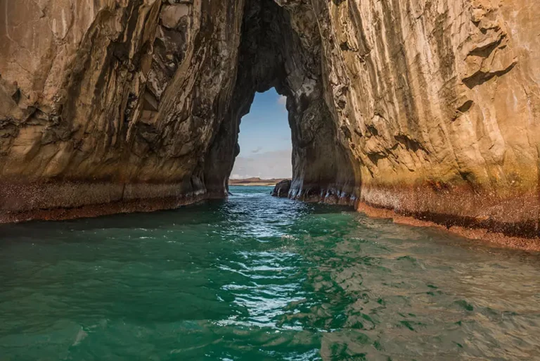
One of the largest islands in the easternmost end of the archipelago. Puerto Baquerizo Moreno is a small town, and the capital of the Galapagos province. Its airport is one of the two that connect to the mainland.
- Wildlife highlights: Colony of Galapagos sea lions, Darwin’s finches, marine iguanas, lava lizards, giant tortoises.
- Unique features: San Cristóbal mockingbird, San Cristóbal lava lizard, coralline beaches, El junco (the only permanent fresh water lagoon in the Galapagos).
- Visitor Sites: La Galapaguera, Cerro Brujo, Punta Pitt, Tijeretas (Frigate Hill), Interpretation Centre.
Santa Cruz Islands (Indefatigable)
The second-largest island of the Galapagos group with all seven vegetation zones included across its expanse. The largest human population lives on this island, mainly in Puerto Ayora, the largest town in the archipelago. Many urban features are found here: banks, ATM machines, souvenirs, art, restaurants and bars.
- Wildlife highlights: Darwin’s finches, giant tortoises, Galapagos mockingbirds, vermillion flycatchers, herons, egrets, ducks, stilts.
- Unique features: giant tortoises in the wild, giant tortoises at the Charles Darwin Research Station (young & adult), vegetation of the highlands including the giant daisy tree of the Scalesia genus, a variety of nature-active options and physical activities (hiking, scuba diving, mountain biking, kayaking, etc.).
- Visitor Sites: Charles Darwin Research Station, The Highlands and the Giant tortoise reserve, Los Gemelos (Pit Craters), Cerro Dragón (Dragon Hill), Bahía Ballena (Whale Bay), Las Bachas beach
Santiago Island (James)
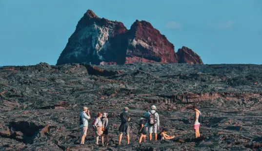
This former large shield volcano looks more like a mountain range with hills, valleys and plenty of parasitic cones. An Ecuadorian group settled here within the 1960s for a salt-mining related business. The island is now uninhabited and provides a great visitor site at Puerto Egas, which combines a visit along the rocky shoreline with time on its dark-colored sandy beach, and at Sullivan Bay with its fascinating lava.
- Wildlife highlights: the most diverse shorebird activity occurs here; Galapagos fur seals, Galapagos sea lions, hawks, Darwin finches, mockingbirds, and marine iguanas.
- Unique features: a rugged and well-eroded coastline made of tuff stone lies above a dark black lava flow. Such tuff stone was probably the result of a gigantic phreatomagmatic explosion (abrupt contact of water and magma) that even included base surge. Within the actual coastline, the most incredible habitat will host intertidal life, next to Galapagos fur seals.
- Visitor Site: Sullivan Bay, Puerto Egas.
Santa Fe Island (Barrington)
Santa Fe is a small island located in the centre of the archipelago. Studies suggest that Santa Fe Island could be the oldest Galapagos volcano, there are sub-aerial rocks dating back 3.9 million years. The vegetation of the island is characterized by brush, palo santo trees, and stands of a large variety of the prickly pear cactus Opuntia echios. The visitor site is a wet landing located in beautiful Barrington Bay on the northeastern side of the island. Large numbers of sea lions are found on the beaches in the turquoise waters of the bay.
- Wildlife highlights: sea lion colony, Darwin´s finches, Santa Fe land iguana, giant Opuntia Cacti, Galapagos Hawks
- Unique features: large Opuntia Cacti forest, home for the unique species of land iguana (Conolophus pallidus) in the world. It has one of the most beautiful bays, an ideal place for snorkeling.
FAUNA
Iguanas
Marine Iguanas
The unique Marine Iguana of Galapagos Islands.
An endemic genus with one species and seven subspecies. The age of the iguana could be nine million years or more if we consider the fact that it is older than the islands existing today. It is descended from a land iguana from the South American mainland. It most probably reached the Galapagos via vegetation rafts that were drifting on the surface of the ocean. Consequently, it had to adapt to a strictly vegetarian seafood diet.
The only marine iguana in the world, the Galapagos species is found along shore on lava rocks. The length, including the tail, ranges from 60 centimeters for the smallest variety (Genovesa Island) to one meter for the largest (Isabela Island). The tail is half the size of the body. The sooty-black skin- a mimetism with the black lava substrate – is a camouflage against predators and enables the iguana to absorb more heat during its exposure to the sun.
Land Iguanas
Endemic Land Iguana.
This endemic genus has officially two species, but may have one more if one considers the possibility of an endemic species on Fernandina Island. Yellow-orange to brown, the land iguana differs from the green iguana, Iguana iguana, of South America and the Caribbean, ancestor of the Galapagos iguanas, by a lack of fear towards man. In Galapagos, two species of land iguanas have been identified:
- Conolophus subcristatus: on Santa Cruz, Plaza, Isabela and Fernandina (yellow-orange)
- Conolophus pallidus: on Santa Fé (whitish to chocolate brown). This is the biggest land iguana; the male weights six or seven kilograms, the female three kilograms. The eyes are often red.
Conolophus feeds on grass, centipedes and annual plants in season, but its favorite food consists of the pads of the opuntia cactus: especially the fruits and the yellow flowers, during the hot season.
Turtles and tortoises
The Black Turtle
Spot this beautiful creatures in Galapagos shores.
This turtle feeds on ulva, the chlorophyll alga, on the roots of mangroves, as well on the leaves of the red mangrove. Males are smaller than females, with a concave plastron, claws on the bend of the front flippers (to grasp the carapace of the female) and a long tail. Sexual maturity is reached at 20 to 25 years. The mating season starts with the hot season, and the peak reproduction and egg laying occur in December – January. Group mating is easily seen in the lagoon of Tortuga Negra (north of Santa Cruz) in November. Eggs laying takes place generally between January and June, but may occur all year-round. Gestation lasts for about two months. The temperature of the incubation influences the sex of the individual. The egg-laying frequency is every two to three years. The main predators of the marine turtles are sharks, orcas and crabs.
Giant Tortoise or “Galapago”
Our gentle giants are one of Galapagos iconic species.
Only two island groups in the world are inhabited by giant tortoises: Aldabra Island in the Seychelles, and the Galapagos Islands. Giant tortoises would have to have reached the Galapagos by floating from South America, which seems unbelievable. The most likely ancestor, Geochelone chiliensis, originally came from Argentina, but nothing explains its tortoises were in the beginning.
In the Galapagos, female tortoises can weigh up to 50 kilograms and males up to 250 kilograms. Isabela Island, with more than 6,500 individuals, remains the island with the largest giant tortoise population.
Galapagos Penguin
Don’t miss the opportunity to watch this adorable species.
Endemic. Belongs to the order Sphenisciformes, birds that cannot fly, and in which the wings evolved for use as fins. The Galapagos penguin is related to the Magellan penguin, Spheniscus magellanicus, an ancestor thought to be found in southern Chile. It is also related to the penguin of the Falkland Islands and islands near Antarctica. This penguin came to the Galapagos Islands by means of the Humboldt Current.
The Galapagos penguin swims with its front fins, and its feet help in steering. Swimming slowly at the surface, it moves very fast underwater and sometimes leaps above the water happily; in dolphins, this behavior is known as “porpoising”. On land the Galapagos penguin walks, hops from rock to rock, and goes “tobogganing”. Head and beak movements can be an appeasement response to threatening behavior.
Cormorant
Its name comes from the fact that these birds are unable to fly.
Endemic. It is a larger dark bird with atrophied wings and a strong, long beak with a hooked end. Adults are black above, brown underneath, and have turquoise-blue eyes. The young are black all over, with dull eyes. Males are larger than females.
Cormorants are often seen above the tideline, with wings spread out to dry in the wind. This is an ancestral habit that is useless since the bird cannot fly. A lack of predators has influenced its flightlessness.
Like a penguin, it swims underwater and uses webbed feet. It feeds on fishes, eels and octopus. Being endemic to the Galapagos, it is one of the rarest birds in the world. Its population is estimated at 1000 individuals.
Swallowtail Gull
The wonderful Swallowtail Gull.
Endemic. The only gull present in the Galapagos. It is differentiated from the lava gull by a black and white spotted swallowtail and a red eye ring. The body is pale grey on its back , ventrally white. The beak is black with a white tip, and the feet are red . The white marks at the base and tip of the beak help the chick in the nest to see the arrival of its parent at night. Consequently, to obtain food, it will just knock on the beak of the adult. Big black eyes are characteristic of the swallowtail gull, which feeds only at night. Its nocturnal vision is made possible by the red eye ring which serves as a sort of sonar. It feeds offshore looking for fish and squid. Their cry is unique and resembles a clanking whose possible function may be compared to echolocation.
Waved Albatross
This species are only found during Galapagos dry season.
There are 13 species of albatross in the world. One of the most majestic birds in the archipelago, the waved albatross is endemic not only to Galapagos, but also to the island of Española, for this is the only place in the world where it reproduces. This cousin of the petrels and the puffins, has a population of nearly 24.000 individuals. Weighing four kilograms, and with a wingspan of 2,5 meters, this is the largest bird in the Galapagos.
With sufficient wind, the albatross in flight is a tremendous glider, but in calm weather it has to move its wings harder than other birds.
Great Frigatebird
Observe the impressive red chest of Frigatebird.
Belongs to the order of Pelicaniformes, which are recognized by reduced or absent external nasal slits.
Frigates, or “vultures of the sea”, are specially designed for the life aloft. Their wingspan is as big as that of the albatross. This bird, having lost the waterproofing of its black plumage, never lands in the sea. Frigates spend time gliding in circles in the sky. When in pursuit of other birds – especially boobies, for example, which they frequently harass for food- they may be very fast. Frigates may also catch small fish on the surface of the water with the mere swipe of the hooked beak.
uring the courtship display, the male inflates a huge leathery red pouch under his throat. This seduces and attracts the female to the nest, which the male has already prepared for the purpose of mating.
Magnificient Frigate
Tropicbird
Is very similar to the great frigate, but the male has a purple sheen on its black plumage, and the female has a black triangle on the white patch of the throat. The eyering is bluish-green on both sexes. Unlike the great frigate, the magnificent frigate is an “inshore feeder”, and feeds near the islands. On North Seymour, where it is easily seen, courtship displays are observed throughout the year. It is also a tropical breeder, with long reproduction cycles. Only one egg is laid, with an incubation time of 55 days.
Tropicbird

This beautiful white bird with short wings has two long and narrow feathers extending from the tail. A black line runs through the eyes, and the bill is coral red in adults. The juvenile lacks the two tail feathers. Its food being pelagic, the tropicbird is an “offshore feeder”. It feeds on fish and squid by plunge-diving during the daytime. The Tropicbird reproduces in colonies, and lays only one red-brown, spotted egg in a crack of a cliff or between rocks. There is a noticeable difference between the reproduction cycles of the tropicbirds on South Plaza, Genovesa and Daphné Islands.
Boobies
Boobies are very common in the islands. Three species are seen in the Galapagos: the blue-footed, the red footed and the Nazca booby. All have an aerodynamic body and a long, pointed bill.
All three live in colonies, but with various habitats. The name “booby” may derive from the fact that – once they have seen fish while flying – they drop on it like arrows from a height of fifteen meters. Well adapted to extensive flight when looking for food, boobies have the ability to plunge-dive and move underwater, when fishing. Boobies incubate their eggs with their webbed feet and not with an abdominal pouch.
Red-Footed booby

This is the lightest booby, with a weight of about one kilogram. Color is light brown, with a bluish beak. There is also a white variety, called the “morpho blanco”. The red feet are adapted to gripping branches; thus it is the only booby to nest in trees. The reproduction season depends on the availability of food. The chicks may easily die from hunger the first weeks of their life. Despite the high mortality rate, only one egg is laid. The time necessary to breed young does not allow an annual cycle of reproduction.
The red-footed boobies are the largest community of boobies in the Galapagos. The population of the archipelago is 250.000 individuals.
Blue-Footed booby
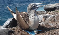
The blue-footed booby is unique specie that can only be found at Galapagos.
This is the most common booby. The Galapagos subspecies is endemic. Its lifespan is about 15 to 20 years. Unlike its red-footed relative, the blue-footed booby fishes inshore. It nests on the coast. The nesting site, on the ground, is marked by sprays of ejecta which draw a radiant white sun on the volcanic sand. Food is usually abundant, and allows two or sometimes three eggs to be laid.
The male is lighter than the female and plunge-dives more easily than female. The male whistles, and the female honks. During the mating season, the booby dances with its turquoise-blue feet, spreads out its wings, brings its tail up, points its bill to the sky and whistles loudly. This ceremony is known as the “sky pointing display”. The population of the blue-footed boobies has been estimated at 10,000, but it may be much more.
Nazca booby
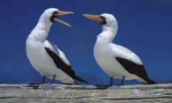
Last but not least important the Nazca booby which is also known as the masked booby.
Formerly known as the masked booby but discovered to be a new species in 2001. Is the heaviest of the three boobies. The plumage is white, wings are fringed with black, and the beak is orange yellow. The conspicuous black mask on the eyes makes it easy to recognize. Like the blue-footed booby, the white Nazca booby nests directly on the ground and surrounds its nests with waste. It chooses the site on clifftops, where the air streams allow it to take of easily. The fishing zone is intermediate between those of the other booby species, is between islands. The population of the Nazca boobies is about 25,000.
Flamingo
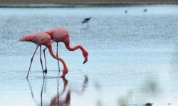
Don’t miss the opportunity to watch this magnificent Flamingos.
Rare in the Galapagos, is found in seven salt water lagoons, behind the mangroves of the littoral. Flamingos may only reside in places where the water is not too deep for wading.
Swinging his neck right and left, it searches for food in the silt, thanks to a sonar in the bill which enables it to detect organisms. Flamingos feed from seven to twelve hours a day.
Galapagos Hawk
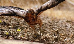
Meet the endemic Galapagos Hawk.
Endemic. This magnificent
predator was for a time extinct on Santa Cruz. But recently there was a return of the Hawks to the highlands of that island. The hawk is common to the Pinzón island, and to Santiago, and Isabela islands.
The adult has dark brown plumage, a tail striped with white and yellow legs. Juveniles are lighter and speckled with white. This bird of prey is unique, having no predators itself, and is therefore on the top of the food chain. With its sharp eyesight, the hawk may detect prey – mainly lizards, iguanas, snakes, finches, boobies, flycatchers and young goats – from a great distance. It will also eat dead animals such as sea lions, sea birds, marine iguanas, goats and fishes.
Galapagos Mockingbird
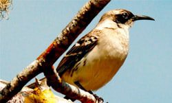
The ancestor of the Galapagos mockingbird is the longtail mockingbird. In Galapagos the four species and six subspecies of mockingbird are all endemic:
The noisy birds very curious by nature, are gryish brown dorsally and cream-colored ventrally. The beak is black and curved downward.
Predatory birds, they feed on small finches, lava lizards, centipedes and insects. They also crave the eggs of the sea birds, such as boobies and albatrosses. Very social birds, they have no fear of man, and are quite common to the archipelago.
Darwin Finches
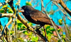
The theory of evolution brought fame to Darwin`s finches. The dark-coloured birds are about the size of a sparrow and are distributed on all the islands. They are often very noisy birds and have no fear of man.
Although they belong to the finch family, they make a subfamily called Geospiznae, which is found only in the Galapagos and on Cocos Islands to the northeast. Thirteen species are endemic to the archipelago; all originated from an original species, Melanospiza richardsonii, found on St Lucia Island in the Caribbean. All the finches are strikingly alike, and it takes the trained eye of and specialist to distinguish them perfectly.
Sea Lion
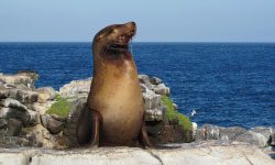
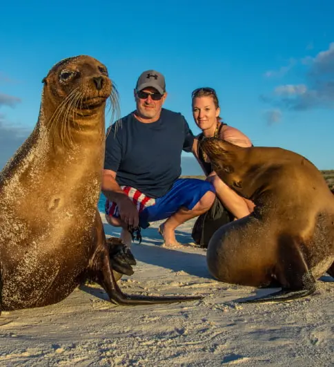
Abundant in the archipelago, sea lions gather in colonies on the sand or on the rocks. The male is polygamous, but there is no such thing as a harem in the strict sense of the word, for the female is free to come and go as she pleases, in and out of the group. The male is distinguished from the female by its huge size and by a conspicuous hump on the forehead, while the female has a smooth forehead.
The male is very territorial, especially at the beginning of the mating season, and patrols on the beach or in the water constantly to chase occasional intruders. He keeps an eye on the young, which may wander off too far from the safety of the beach, and may be attacked by sharks. The sea lion may dive to a depth of 30 to 60 meters, and dives down to 100 meters have been recorded. It feeds during the day.
Fur Sea Lion
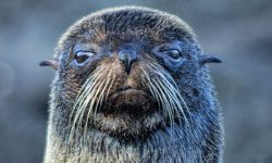
This species originated in the southern hemisphere, and reached the islands via the Humboldt Current. Fur Sea Lion may be easily distinguished from the sea lion by its smaller size, its pointed nose, and big round sad eyes with a glossy glare. Most of the times it lies under rocks or in lava cracks, hiding from the sun.
Flora
Most likely the flora of the islands started this way:
- With spores and seeds carried by the winds and “stopped” by the newly formed islands.
- By seeds stuck to feet and plumage of migratory birds, or passed through their digestive system.
- Via chunks of vegetation rushed to the sea by overflowing rivers and conducted throughout the ocean by the marine currents.
It happened then, it happens now. Not all seeding can “fuse” with the rocky land. Only those with simple germination necessities can adapt to the barren environment to survive and evolve in forms growing every day.
Going from shores to highlands, it has been agreed to define five zones of vegetation life in Galapagos:
- Coastal. The sea borders are apt to saltwater plants like the Red Mangrove, with its typical aerial roots in Isabela and Santa Cruz; and the Beach Morning Glory abundant in Santiago.
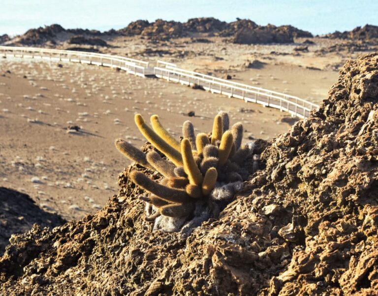
- Arid. Cacti territories! Among a good variety, the big and famous Opuntia Cactus, (prickly-pear) in many places the only source of food and moisture for reptiles; and the graceful Candelabra Cactus. Among the newer black lavas you find Brachycereus Cactus (or aptly called lava cactus). Another typical of the zone, and common on all large islands, is a Bursera Tree of light bark called Palo Santo (holy wood), after the reddish sap that bleeds from wounds. High number of endemic plant species.
- Humid. Epiphytes like orchids, mosses, ferns and lichens thrive in this zone’s constant moisture and ornate trees and shrubs with color and charm. Typical at this degree of humidity are the Scalesias and Pisonias. Not much is said about the highlands of Galapagos, but in reality, this is an amazing cloud forest with unique features.
- Miconia. Particular to San Cristobal and Santa Cruz, this zone is named after the ever-present Miconias that require high humidity.
- Pampa. In the populated islands, this is farmland or Pampas. The temperature is low and grass is abundant; good to cultivate commercial products and raise cattle.
Cacti
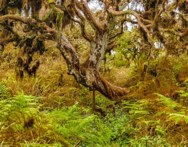
Scalesia
Park Rules
Ecuador established the Galapagos Islands National Park in 1959 covering 90% of Galapagos Islands area, all the lands are already included, the Galapagos Islands national park service was started in 1967 until today. The Galapagos Marine reserve was open in 1999 to preserve the marine wildlife in the sea near the Galapagos Islands. For more information, read about it in Galapagos Park Rules blog.
Our environmental policy, allow us to generate conscience in our guests towards the protection of the ecosystems we visit. All our expedition staff will motivate guests to follow the good environmental practices of our operation.
The Galapagos National Park Service regulates all visitor activities within the park’s boundaries, including the vessels itineraries. Visits both within the National Park sites and the Marine Reserve are led by licensed Naturalist Guides. By following these rules, you are directly contributing to the ongoing preservation efforts of local institutions. Take only photographs and wonderful memories; leave only footprints.
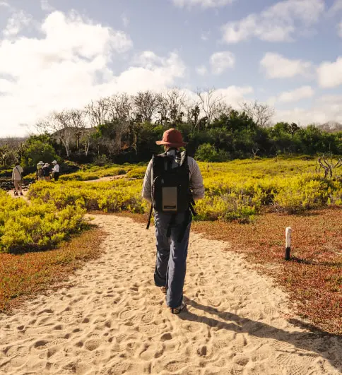
- Please stay on the trails.
- Please do not disturb any wildlife or remove any native plant or rock material.
- Please make sure you do not accidentally transport any live material to the islands, or from island to island. Insular ecosystems are fragile biological units.
- Please be cautious at approaching wildlife, and always follow your Naturalists´ advice.
- Animals are not to be fed by humans. Particular attention should be given to water bottles.
- It is prohibited to bring food to the visitor’s sites.
- Please do not startle or chase any animal from its resting or nesting area.
- Smoking is not allowed on the islands, nor is it in any boat (dinghy) during your visits. The use of cellular or satellite phones is prohibited on the visitor’s sites.
- Please do not buy any souvenirs made from native Galapagos species (except for wood).
Conservation is everyone’s business. Please do not hesitate to show your conservationist attitude. Become a Galapagos supporter and ask us about our conservation programs that support sustainability on the islands.
Are you coming to Galapagos? Don’t miss these tips before your trip
Listed below find all the information you need to know before traveling to the Galapagos Islands. Additionally, make sure you read our blog on the 3 Most Important Hacks to Choosing a Galapagos Cruise! It’s the small (but big) details that make all the difference!
Please don’t hesitate to contact us if you have any questions or queries!
Packing
- 1 Small backpack (waterproof)
- Sneakers with rubber soles and/or “Teva” type sandals
- Shorts and long pants
- T-shirts, long- and short-sleeved shirts
- Windbreaker
- Bathing suits (wetsuits are available onboard all our ships)
- Hat or cap
- Toilette kit (biodegradable please)
- Lots of sunscreen!
- Sunglasses
- Any medicine you may be taking
- Chargers for electrical equipment
- Plug adaptor
- Emergency Contact Information/Insurance numbers
- Passport
Use the hashtag #happyingalapagos when posting to Facebook, Twitter or Instagram!
Luggage
Ecuadorian law stipulates that all checked baggage going to Galapagos must be inspected in order to prevent the introduction of alien organisms to the Islands which could cause serious damage to the unique ecosystems of the Archipelago. Each passenger is allowed one bag of up to 23 kg (50 lbs.) each, plus carry-on luggage, a photo or video camera and binoculars. Professional film equipment and oversized scuba diving gear require special permits and prior arrangements.
What to Wear
For travel in the Galapagos, clothing ranges from informal to very informal. Essentials include sneakers, shorts, long- and short-sleeve lightweight shirts, bathing suits, a wide-brimmed hat, long trousers/pants, light fleece/sweater, and a windbreaker or light jacket for evenings. Be sure to bring a hat and sunglasses and apply your sunscreen. For evening activities, casual attire is suggested. Footwear should give your feet protection, comfort, balance and grip. For this, we suggest tennis shoes or mid-ankle hiking boots. The use of sandals, flip-flops or Tevas, may give you practical freedom, but remember your feet will be directly exposed to a rugged outdoor environment.
Check out our What to Wear aboard a Galapagos Cruise blog for more detailed information.
Weather
The Galapagos Islands are located on the equator. The tropical heat, however, is tempered by Pacific breezes.
There are two seasons in the islands: the rainy, hot season from December to June when humidity is high and average temperatures are in the 80s F (26°-30° C). There may be occasional showers, but the days are generally hot and sunny.
From June to November, you can expect cool winds, occasionally bringing with them a light misty-type drizzle called “garúa.” Temperatures average in the 70s F (20°-24° C) during the day and lower at night.
Follow the link for more detailed information on when is the best time to travel to Galapagos!
Passports
Passengers must travel to the Galapagos with their passports.
Galapagos Fee and Entry Procedure
- Galapagos National Park Entrance fee: $ 100 per person.
- Migration Control Card: $ 20 per person.
- Rates are subject to change without notice.
- The Galapagos National Park authorities charge an entrance fee of $ 100 for all foreign visitors, and the Galapagos Provincial Council charges $ 20 for a migration control card. These fees must be paid in cash (unless pre-arranged). Traveler checks and credit cards are NOT accepted. These fees are subject to change without previous notice.
- The procedures for registering for entry to the Galapagos are due to change, so please consult us regarding these. A pen to fill out forms is useful!
Electric Current
110/AC. Electric shavers can be accommodated. Hairdryers are offered aboard all our ships and in all our hotels.
Local Time
GMT minus 6 hours in the Galapagos Islands. GMT minus 5 hours on mainland Ecuador.
Photography
In Galapagos, everyone always takes far more photos than they thought they would, so bring extra memory cards! Waterproof, underwater cameras are fun and recommended. Keep in mind flying drones is not allowed inside the Galapagos National Park.
Purchases on Board
US dollars may be used to pay for extras such as beverages, souvenirs, boutiques items, tips, etc. Credit cards (Visa and Master Card) are also accepted aboard the Santa Cruz, Isabela II, La Pinta and the Finch Bay Galapagos Hotel
Important: Changes to Itinerary
Changes in National Park policies, seasonal fluctuations, safety reasons and weather conditions may occasionally require schedule changes in itineraries without prior notice. These decisions are taken with guest safety in mind and in the interests of the islands’ conservation.
Safety first with Metropolitan Touring
For Metropolitan Touring, the health and safety of our guests and crew is a top priority in all aspects of our operations. Our vessels undergo a number of strict internal and external control inspections. They comply with both international and Ecuadorian regulations, ranging from the International Maritime Organization (IMO), the International Convention for Safety of Life at Sea (SOLAS 74), Smart Voyager best environmental and social practices, the Ecuadorian Merchant Marine Office (DIRNEA), among others.
On all of Metropolitan Touring’s operations, the competence of crew members is verified, the quality and state of vessels’ equipment and materials checked, periodic maintenance and training performed, and safety procedures and equipment constantly monitored.
Booking, Payment And Cancellation Policies
We only require a 10% deposit per person, when you confirm your booking. Total payment for your tour will be due 60 days before your trip begins.
Additionally, you may ask your destination expert about customizing your payment plan.
This is your ultimate source for Galapagos Islands Information! On this page, you will find everything you need to know about Galapagos Flora, Fauna, Climate, Geology, Park Rules, and Important Tips for your upcoming Galapagos Tour.
Additionally, here’s a shortlist of our blogs that are relevant to this topic.
General Galapagos Information |
Galapagos Weather Information |
Galapagos Cost |
Galapagos Nature & History |
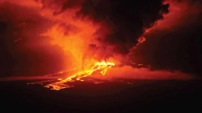
The volcanic set up of the Galapagos can be explained by looking at the theories of Plate Tectonics and the Hot Spot. The platform where the islands started their volcanic growth lies right on top of the Nazca Plate. This plate, neighbours with the Cocos and Pacific Plates, moves towards the South American continent at a rate (call it island speed) of about 7 cm/year (2.756 inches), “carrying” the islands on top.
Underneath certain plates heat from the core of the Earth is transferred to the surface, these areas are called Hot Spots. Hot spots allow (magma) to percolate towards the plate filling up all cracks, crevices and in some cases reaching from below the bottom of the ocean, and eventually breaking the surface of the water. These forces create islands in the middle of the ocean, as is the case of Iceland, Azores, Canary, and the closest example, Hawaii.
As the plates move in one direction, and over time, a chain of islands will be formed. These islands will all be different from each other in terms of age, altitude, and other physical factors like erosion, colonization, etc. In Galapagos, the islands to the east are older than those to the west; this implies that the Galapagos Hot Spot is right under Isabela and Fernandina, the westernmost islands. As you visit the islands, you will notice how different landscapes are, and more so if you see the opposite islands from east to west. The islands continue on being active, and any new eruptions will occur most likely in the west of the archipelago.
The ages of the varied islands differ a lot; Española (Hood), Santa Fe (Barrington) and Floreana (Charles) belong to the group of older islands with ages that range 3 – 3.5 million years. Islands within the middle range date anywhere between 2 – 3 million years, like Santiago (James), Santa Cruz (Indefatigable) and Bartolomé. To the west, we find the youngest rocks on both Isabela (Albermarle) and Fernandina (Narborough); these barely reach a million years.


